08/07/2023
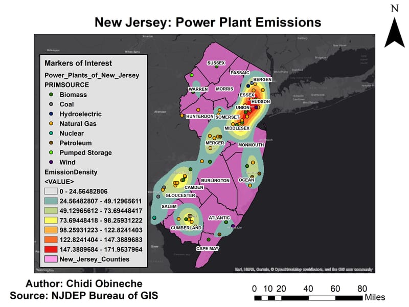
Geodatabase Creation for the Monitoring of New Jersey’s Air Pollution
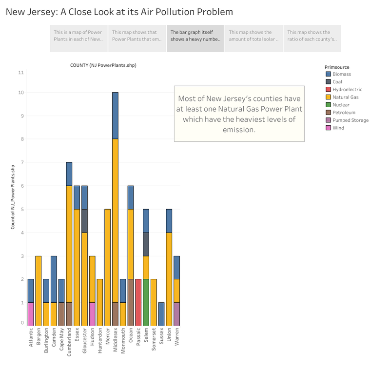
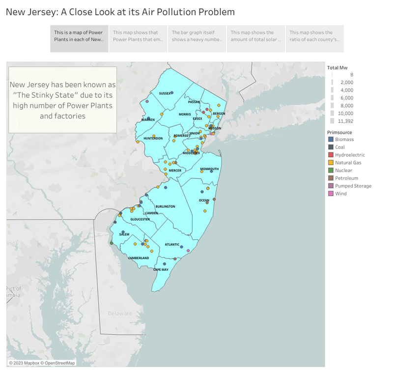
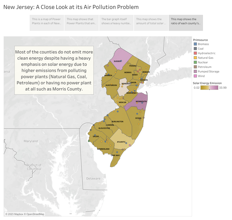
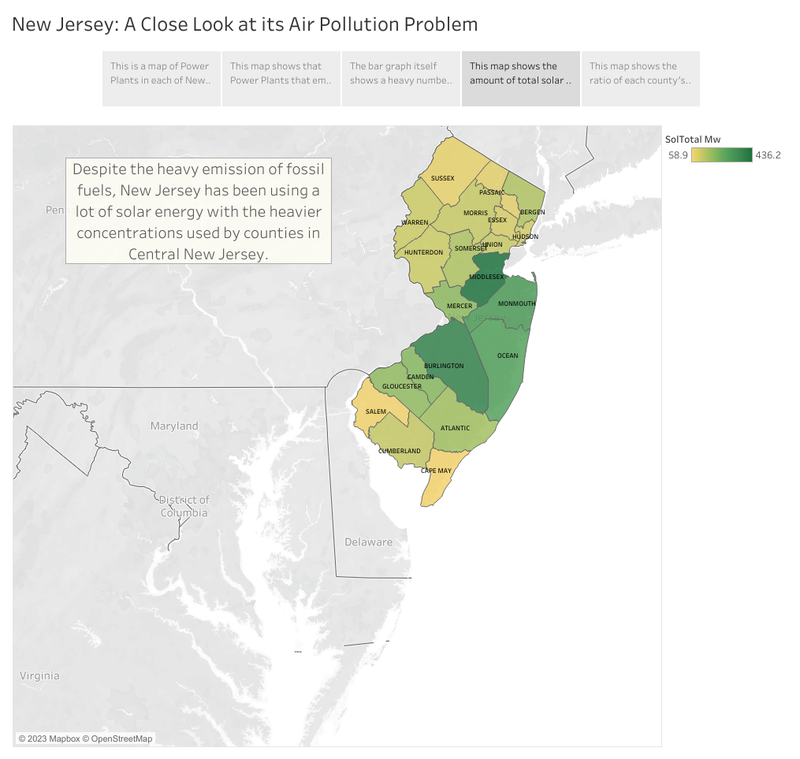
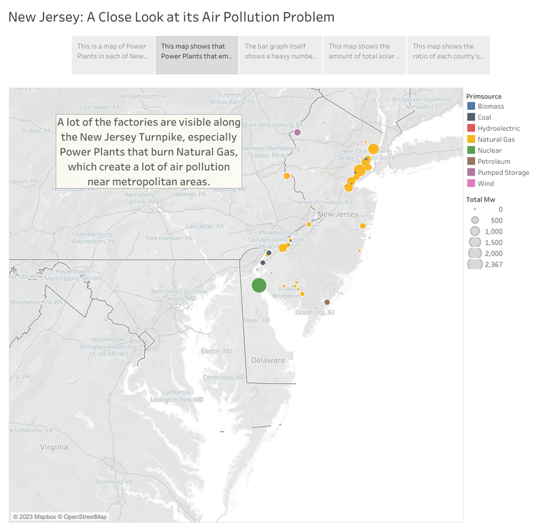
In one of my graduate class projects, I wanted to investigate the main causes of New Jersey's air pollution by focusing on the power plants and what they emit. When creating the geodatabase in PostgreSQL, I used ArcMap to help make a map showing the heavy emissions produced by power plants in the state using a Kernel Density Analysis and determined that Power Plants that burn fossil fuels (Natural Gas, Petroleum, Coal, Biomass) contribute the most to New Jersey's air pollution with Natural Gas having the most contributions. During the height of the COVID-19 pandemic, I learned about Tableau from a colleague and used it to enhance my old Power Plant Map. I learned the basics of how Tableau worked with GIS data and used the maps I made to create a Tableau story that highlights how most of the air pollution produced by power plants occur in the southwest and northeast edges of New Jersey, with those power plants located near highways. I also compared the solar emissions produced by New Jersey at the county level with the number of power plants, and despite the heavy presence of solar energy in the state, it is not enough to counter the the heavy emissions produced by the power plants. I 've left a link to the story uploaded to Tableau below. Link to Tableau story: https://public.tableau.com/app/profile/chidi.simon.obineche/viz/NewJerseyPowerPlantMap/Story1
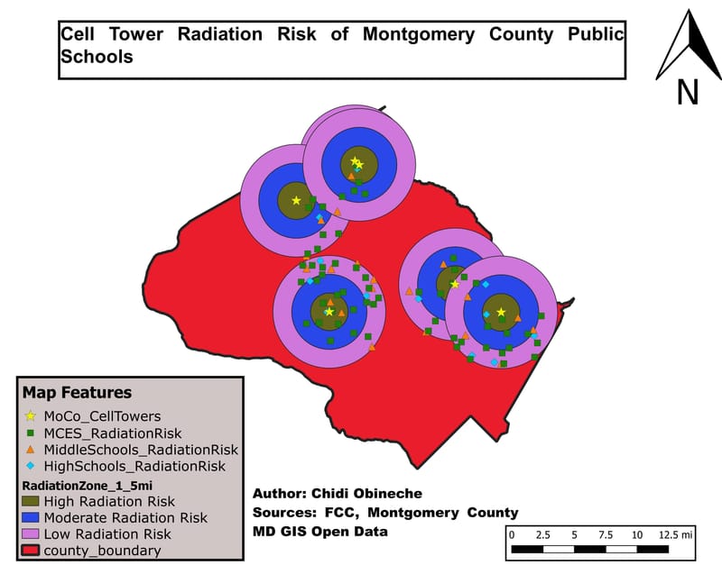
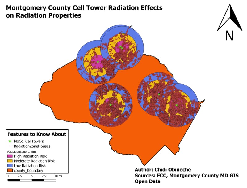
The Long-term Risk of Radiation from Cell Phone Towers in Montgomery County, Maryland
This project involved investigating the number of houses and schools in Montgomery County, Maryland that had the highest risk of suffering from the long-term effects of cell tower radiation. I used a Multiple Ring Buffer around the cell towers using a 1.5-mile gap to separate the high risk, medium risk, and low risk zones.. • Out of the 254,837 Residential Properties, 111,508 of them are within the radiation zones. (Around 43.8%) • 22,558 Residential Properties have the highest risk of suffering from the long-term effects of cell tower radiation. (20.2%) • 42,981 (38.5%) of the Residential Properties in the radiation zones have a moderate risk of long-term effects • 70,597 (63.3%) of the Residential Properties appear to have the lowest risk of long-term radiation effects. There appears to be more houses with a low radiation risk. • The amount of points recorded do feel suspicious since when the amounts are combined the sum turns out to be more than 111,508. • There are a total of 197 public schools in Montgomery County (133 are elementary schools, 39 are middle schools, and 25 are high schools) and 92 of the public schools are at risk from long term effects of cell tower radiation (60 elementary schools, 20 middle schools, and 12 high schools). • Elementary Schools: 15 schools have the highest long-term radiation risk, 20 schools have a moderate risk of long-term radiation, and 37 of the schools have the lowest risk of long-term radiation effects • Middle schools: 6 middle schools have the highest risk of suffering the long-term effects of radiation, 4 middle schools have a moderate risk of long-term effects, and 15 of the schools show the lowest risk of long-term radiation. • High Schools: 4 high schools have the highest risk of long-term radiation effects, 4 high schools have a moderate radiation risk, and 7 high schools have the lowest radiation risk. • It looks like most of the public schools fall under the lower radiation risk zones of all of the cell towers, but the numbers look inaccurate due to the overlapping of radiation zones.